Hello,
We are trying to optimize the workflow for transferring geometry and information from IFC to the GIS system. Does anyone have any experience to share on this topic?
Hello,
We are trying to optimize the workflow for transferring geometry and information from IFC to the GIS system. Does anyone have any experience to share on this topic?
Hi @dalvarez and @PepaR
Thanks for the link, but the article describes mostly the collaboration between Autodesk and Esri platform, both proprietary software vendors. There is a paper from 2021 on OGC.org about the possibilities to transform data between IFC and GML. The objective is only about buildings as IFC 4.3 was not released at that time. It is interesting to know how far they are now. You will find the paper her: [19-091r2_Built_environment_data_standards_and_their_integration_an_analysis_of_IFC_CityGML_and_LandInfra.pdf](file:///C:/Users/gimo/Downloads/19-091r2_Built_environment_data_standards_and_their_integration_an_analysis_of_IFC_CityGML_and_LandInfra.pdf.
There is more involvement of GIS than the other way around.
As a matter of fact i am testing a tool called ‘IFC envelope Extractor’ from TU Delft
Makes really neat outershells.
Several actors in the field of land management are developing their own approaches to this integration, transferring topographic bases to IFC and generating urban IFC models. This process has been implemented in Catalonia (as demonstrated in a referenced video), by AMB (Àrea Metropolitana de Barcelona). At a Spanish level, AMB also leads the development of a national standard (hopefully in the future it could be international) about the transformation of topographic bases to the IFC data schema. (initially from IFC2x3).
@Gita Thank you for sharing the information about the article. I will take a look at it
did you check CityGeometrix - ifc2gis (IFC to GIS Converter)?
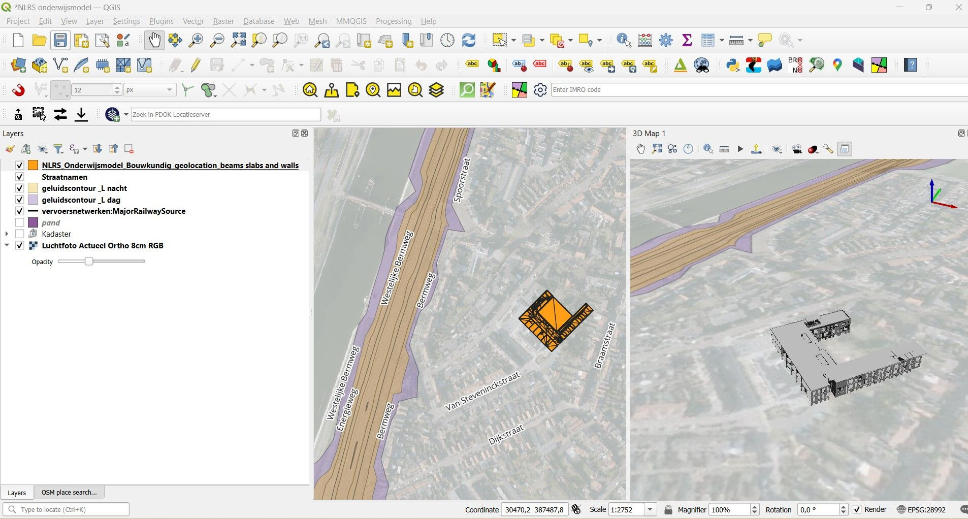
Yes! That’s a very interesting development. We need more people and parties to help bridge the gap to GIS Systems. I will post a short video of the lastest release using the Dutch Revit School model for educational purposes. Which now has the place on the earh called Oost-Souburg. This is the exact plate where people build a school completely wrong.
Here is the news article.
School in Oost-Souburg achterstevoren gebouwd: ‘Bizar
The most importing part to get this done is IFC GEOREFERENCING
Testing the new release for 𝗶𝗳𝗰𝟮𝗴𝗲𝗼𝗷𝘀𝗼𝗻 from Abdoulaye Diakité, Ph.D.
This is a open-source tool for converting IFC BIM data into geospatial GeoJSON files. Which can be used in Qgis. The model for testing i use is a export of the Educational model of the dutch Revit Standards Foundation. Link in the comment. As a concept it works but i think Qgis has issues with loading data in 3D.